Geospatial Analysis with Raster Data
-
Suitability Analysis and Weighted Overlay
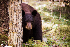
A recent trend in park visitors across the U.S. attempting to take Bear Selfies has led to increased interaction between bears and humans. Despite warnings park visitors continue to try to approach bears to post photos to instagram and other photo sharing services. Capturing and re-locating bears has proven to be unsuccessful as the bears continue to return. Based on several factors we will need to identify the safest areas for bears to reduce the amount of bear-human interaction.
Read more... -
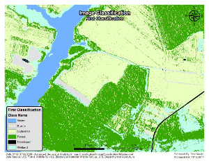
Image Classification
The Blackwater Wildlife Refuge in Cambridge, Maryland is in need of updating it's Refuge Management Plan. This serves as an opportunity to update several GIS layers that were developed for the last plan written five years ago. We now have National Agriculture Imagery Program (NAIP) data from 2010 from which we can derive a land-cover dataset. The classification of land-cover types from this analysis will be used for the rest of the aerial imagery of the refuge in the new Management Plan, and will become the canonical land-cover dataset for the refuge moving forward.
Read more... -
Using Raster Data for Site Selection
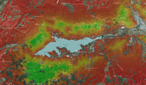
For this exercise I have been contacted by the California State Department of Natural Resources to model Bald Eagle habitat around Big Bear Lake in the San Bernardino National Forest. Rather than a traditional raster-cell based analysis I’ve been asked to conduct a fuzzy-tolerance analysis to account for the Bald Eagle’s instinctual site selection tendencies. This can often give more accurate results as animals are not bound to polygon boundaries, and do not see the world through 30 square meter raster cells.
Read more...
subscribe via RSS